Saturday 1 March 2014

Roopkund - The mystery lake trek


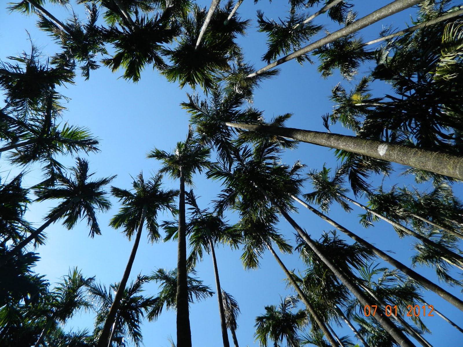
                                       Roopkund is lake situated at around 4,800 meters above sea level (16,500feet). It is also known as the skeleton lake because there are more than 500 skeletons submerged inside that lake. Roopkund is a very good trekking destination, which takes 9 days to complete the entire stretch because of the high altitude.

                    I came to know about this trek somewhere in mid 2012, and then wanted to go there.This year I made up my mind. In Dussehra season, it happened within a week. Planned everything just in 7 days before the trek!! I wasn’t sure after booking the flight tickets, if I had done the right decision or not. I along with my friend set out for this trek, adventure nonetheless. And met another Guy from Chennai in Delhi, who was going for the same trek as we were. I got to admire his courage though.Since we planned it just one week before the trek, we couldn’t get the train tickets to Katgodham (from where IndiaHikes takes us), so reserved 3 seats in Kalpana Travels to Katgodham. We boarded the bus in the night around 9:30pm from the Anand Vihar. The bus was in horrible condition (we regretted our decision there itself). The worst part was they were trying to fill all the seats in the bus wherever possible; He went to Noida stopped there for an hour. Then came back then stopped for 1/2 hour. Well, we were not happy about the condition of the bus; on top of that they were doing this. Well, Kalpana still reminds of the worst possible Trip to Katgodham. (Reaching the destination 2 hours later than we anticipated). It was an experience though!!!

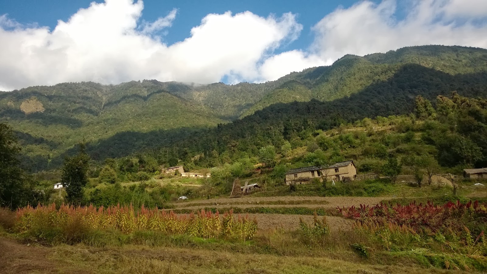
                                First day full of journey from Khatgodham railway station to the Roopkund base camp at Lohajung. It’s 10 hours of journey in the Mountains and valleys.  We didn’t have time to Freshen up. We got down near the Katgodham railway station and boarded the cab. We joined the 2 guys (registered for the trek) waiting for us. Apparently they are from Hyderabad. And that’s how the Group was formed. (5 of us) We didn’t know who rests of the 21 registered people are.
Our driver stopped for breakfast near some Dhaba on the way, We got freshen up and ate like crazy (Rotis, different but good none the less). Then again started and we didn’t have any lunch in-between since we were heavy with breakfast. We reached Lohajung base camp in the evening around 7:30pm.

Day 1: Lohajung Base camp to Didina Village


Didina Village, One of the remote places in the world.
Day started with briefing session about day’s trek. We packed our Bag, I just weighed and it was 9 KGs then!!  After that we walked on a road along the small stream, which flows through, Green all over. But in some of the places we got to see the landslides happened due to the Cloudburst. Half way through there we saw one temple for which we had to climb a bit from the road, every one was in rhythm that no one was interested to visit the mandir. Few steps ahead, one board that points down, says way to “Roopkund Lake”, and yes, it was my first moment of excitement!

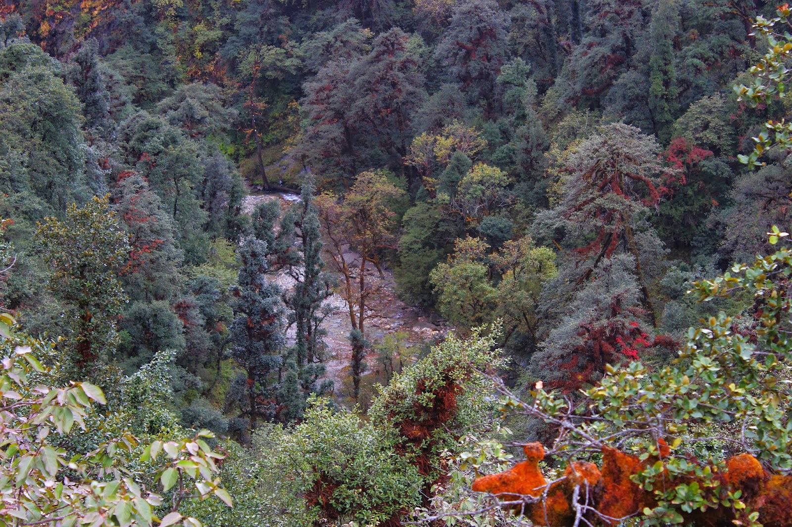
It’s the deep downhill trek in the dense forest, and the time to take out trekking pole out of the bag! I tried to balance with my rhythm with my prior experience in downhill trekking. At the end of the downhill there flows a river, so fresh, so blue, so rushing yet so calm. The “Neel Ganga” River. I haven’t seen a river as clean and as beautiful as this in my lifetime. You just got to believe that the Ganga is still the purest form of water. (Before it enters into land of civilization). We refilled our bottles there and just ate the dry ration that we have collected in the base camp before starting the trek.

2 Floor home stay in Didina Village.
After that it’s gradual ascent, and everyone struggled here. All the food items came out slowly to fulfill the energy requirements. We reached didina village at around 1:30 pm in the noon. It’s one of the most beautiful home stays. The food was good; weather was cold in the backdrop the dense monster forest.  The forest is so dense that, I was feeling as if it was to swallow the village itself. The clouds were playing hide and seek with the mountains. Pure nature unaffected by any external entities. People are innocent yet so hard working, disconnected from the external world. You will be amazed by the kind of flora, fauna and kind of people you see in this village!


Day 2: Didina village to Bedni Bhugyal (via Ali Bhugyal)


Clouds playing hide and seek with Snow capped mountains
We set out for the next task, People say, if you do this, u can do the summit as well.  Yes. It’s the most difficult stretch in the trek, fully into the deep jungle steep ascent for the most part of it. Since it’s a steep ascent you will try to avoid the scorching sun somehow. Day 2 starts very early. (I would say as early as 7am in the morning). So most of trail towards Ali bhugyal is covered with huge trees, which gives us the good shade. One point to keep in mind in this kind of steep ascent is to use the small steps!! Which keeps the rhythm. after almost 3 hrs. of steep ascent you can see biggest meadow in Asia (Ali bugyal). Well, It’s HUGE that’s all I can say. From here everything is visible, Nanda Ghunti, Chowkambha, and Mt. Trishul. And all the green mountains appear to be below us.

Ali bhugyal is situated at around 11,300 feet. You get to see the 360 degree view of things around!! Ali bhugyal is just a midway between Didina and Bedni Bhugyal! We had running lunch in Ali bhugyal. We were so hungry after the steep continuous ascent for more than 3 hours, much needed break it was. After that captured few pictures and set out for our next campsite Bedni Bhugyal. It’s a plain walk in the meadows. Then onwards my cam also joined the party! (Since I wasn’t sure my cam's battery can last for 8 continuous days without a recharge).  And well, at the end of plain meadows, there is a small Mandir, we took break there again!! And started again in the gradual ascent. Then there we actually realized that we are at other side of the mountain we started with. Then some descent and there we can see the mountains above our level!! With pale yellow color, all the water falls gushing through the valleys and finally the campsite. (Open in the air) lies close to 12 tents. It looks like the Rangoli from the top of the mountain we were descending.

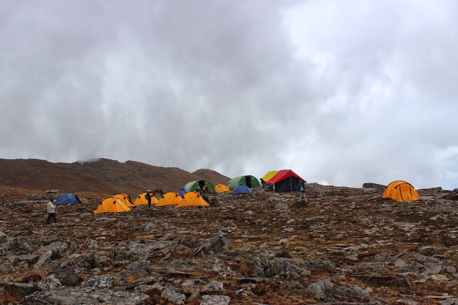
Well, that’s Day no.2. With sudden altitude gain of 3,500feet and temperature drop of 2-3 degrees. (Wait, we are still in single digit :P )!! We had lunch again there; there was nothing different in the menu this time. Same Roti and curry and flavored rice! Anyway I was hungry and I just ate. Some of my friends reluctantly ate it. Then we are assigned with our tents (3 in 1).  We kept our bag inside and came out to play cricket (Probably the cricket played at the highest possible height, close to 13000feet). Looks like Lord Varuna was not happy about it and he suddenly started to pour hails, Wow, it was hailstorm! (First time experience). It continuously poured the hailstones for more than 1/2 hour. While we went inside our tent and shivering out of chill! (2-4’C). There was no sleeping bag inside our tent.
Then it started, discussion about various things, started cracking jokes. You know all the “PUNNY” Jokes. Yes, that’s what happens when you have Joker in your team! You don’t know what you really want to do after hearing those dialogues (laugh or cry).

Never ending meadows of Ali Bhugyal.
After the hailstorm, we came out of tents to see the hailstones accumulated on top of our tent and in the open area, tasted a bit of it. then we walked around the campsite to see what’s there at the edge of every corner! The view was mesmerizing. We went to see the sunset but these clouds refrained from showing it!
Well then it opens up to the north, to see the Majestic Mt. Trishul. It was a Jaw Dropping view of Mt. Trishul in the last rays of the day! You got to see it if you want to know what really am talking about. Then no clouds! It was full moon day and Moon was rising from other side!! Making everything in the camp visible without the need of any torchlight. 7:30pm, and it was soup time. Yay..In that bone biting cold, having a cup of hot soup feels great. Total bliss I would say!
Then in 1/2 hour another whistle for dinner!! (Same menu but few extra things, sweets).

Then right after the dinner we saw the Mt. Trishul glowing in the Moon light.!! What else you need, ending the long tiring day like this, isn’t it?


Day 3: Bedni Bhgyal to Bagwabasa 


Reflection of the Mt. Trishul in the clear Bedni Kund
After the briefing session in the morning, we started the trek. Few minutes from Bedni Bhugyal camp site, there is a Bedni Kund, which has historical significance. The water in the kund is so fresh and one can see the reflections of the surrounding mountain ranges. Kundan is our local guide, he explained us the historical significance of the place. The kund is where actually the Parvathi Devi tried to hide herself from the Raktha Beejasur, and out of anger she became Kali to kill him.  After hearing the story, we thought, we are actually in the right place during Dussehra.

A steep ascent after that, and we got to see some traces of the Ice, which was residue remaining from the last hailstorm it seems! White patches here and there clearly visible. We tried to keep our foot on it, and it was completely slippery after having exposed to morning sun; it was expected anyway. Then we actually realized we are in the ridge between two near mountains. Everything was clearly visible from there, chowkambha, Nanda gunti, Mt. Trishul. It’s the time for dry ration that we collected in the morning.

Bedni Bhugyal Campsite.
Then it was constant walk in the narrow patch in the mountain, right side if you see, it’s the valley full of Greenery and streams flowing through. And right side is the peak of the mountain we are in. It was complete fun!!  We were still at the tail end of the hiking group.
After few hours of gradual walk, we reached a campsite in Patal Nachauni (at least that’s what they call!). We had lunch there, Lemon rice this time. For a hungry soul, anything is like Panchamrutha. As it was already 12.00pm and clouds were playing hide and seek with the mountains. And the wind was becoming chilly and suddenly it started to rain. We took out our raincoat for the first time in the trek!! The entire stretch was steep, very narrow and covered with clouds, we were unable to see everything past few feet!  We felt like we are walking in Mordor!! So chilly it was; everyone was down during in this particular stretch. It was completely visible from their face and body language.:P.  I would say I walked the mordor with 9kg in my back.  It was never ending stretch; time seemed to go very slow while we were struggling. Einstein’s quote seemed so true at that moment “ when a man sits with a pretty girl for an hour, it seems like a minute. But let him sit on hot stove for a minute and it’s longer than any hour”.
We reached Kalu Vinayak mandir at the top of the mountain after hours of struggle!! (We slogged like never before)! It was very chilly; I didn’t even bothered to take out camera to click some pictures! Then it’s normal walk in the narrow way towards bagwabasa. They said it’s 15mins walk from Kalu Vinayak mandir, but that 15mins never seemed to over. Finally we reached what we call bagwabasa campsite. It’s in the foot of giant icy mountains! Visibility was low and more traces of snow now.

We just wanted to lie down inside the sleeping bags a.s.a.p. that day. We got inside the tent and spent the time. Then It was 7:00pm and we had dinner and slept off.


Day 4: Summit Day Bagwabasa -> Roopkund Lake -> Junargali Pass -> Bhagwabasa -> Patal Nachauni


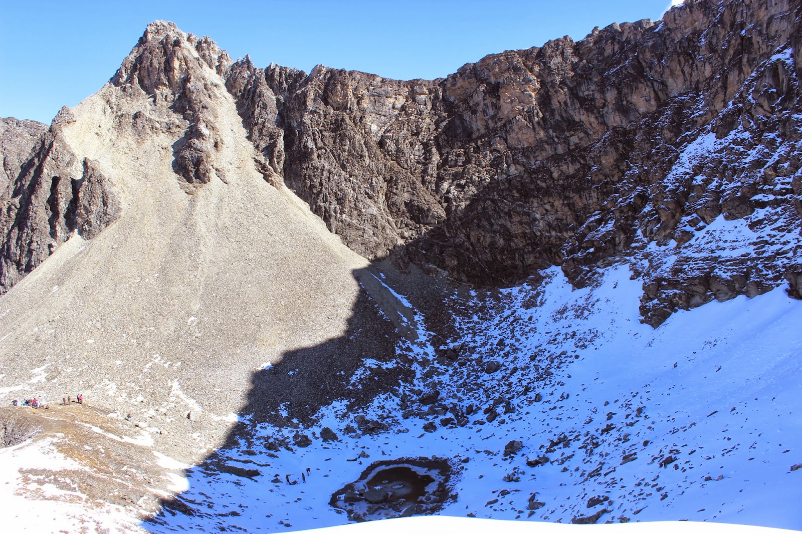
Roopkund Lake (The skeleton  lake)
Summit day starts in the Deva muhoorth (3AM in the morning!). Got freshen up by 3:30am and lite breakfast and collection of the dry ration for the day. 4AM, and we started our hiking in that bone-biting cold (-7 It was). Luckily we didn’t have to carry the entire 9KG bag we carried throughout. Only daypack was enough to carry water in bottles and dry rations! Torch was must. It felt like some devil is taking enjoyment by blowing the cold wind and freezing us. After an hour or so, for the first time I felt like lost somewhere! (Not able to walk!). Bad headache which gradually took control of me, and I fainted at some point. I didn’t have any dry ration to eat! I wasn’t  sure weather to continue or not! My friend gave me a milky bar and drank enough water. I felt better after that. Then it was steep ascent in the narrow rocky patch, very dangerous and cold. After some time it was dawn. Could see the new light! A moment of excitement when you see the first ray of sun touching the snow. And we saw the board  with “Roopkund - 500meters!” written on it. After seeing that excitement doubled in all the tired souls. And after few more narrow, difficult passes there we are, near the Lake I had been talking about for almost 2 years! ROOPKUND Lake, The skeleton lake, at the height of 16,200 feet!!

Junargali Pass
In that excitement we forgot everything!! Nothing can stop us now, we set out for Junargali that’s in 300feet above Roopkund, in full snow. Walking in snow is never easy, that too climbing the steep ascend in the snow. It was first time experience for me to walk fully on snow. It was different. We reached the Summit after 45mins of hiking. We are now at Junargali pass 16,500 feet, the topmost point in the Roopkund mountain range. The moment of immense satisfaction, total bliss! (Nothing can match this particular one).
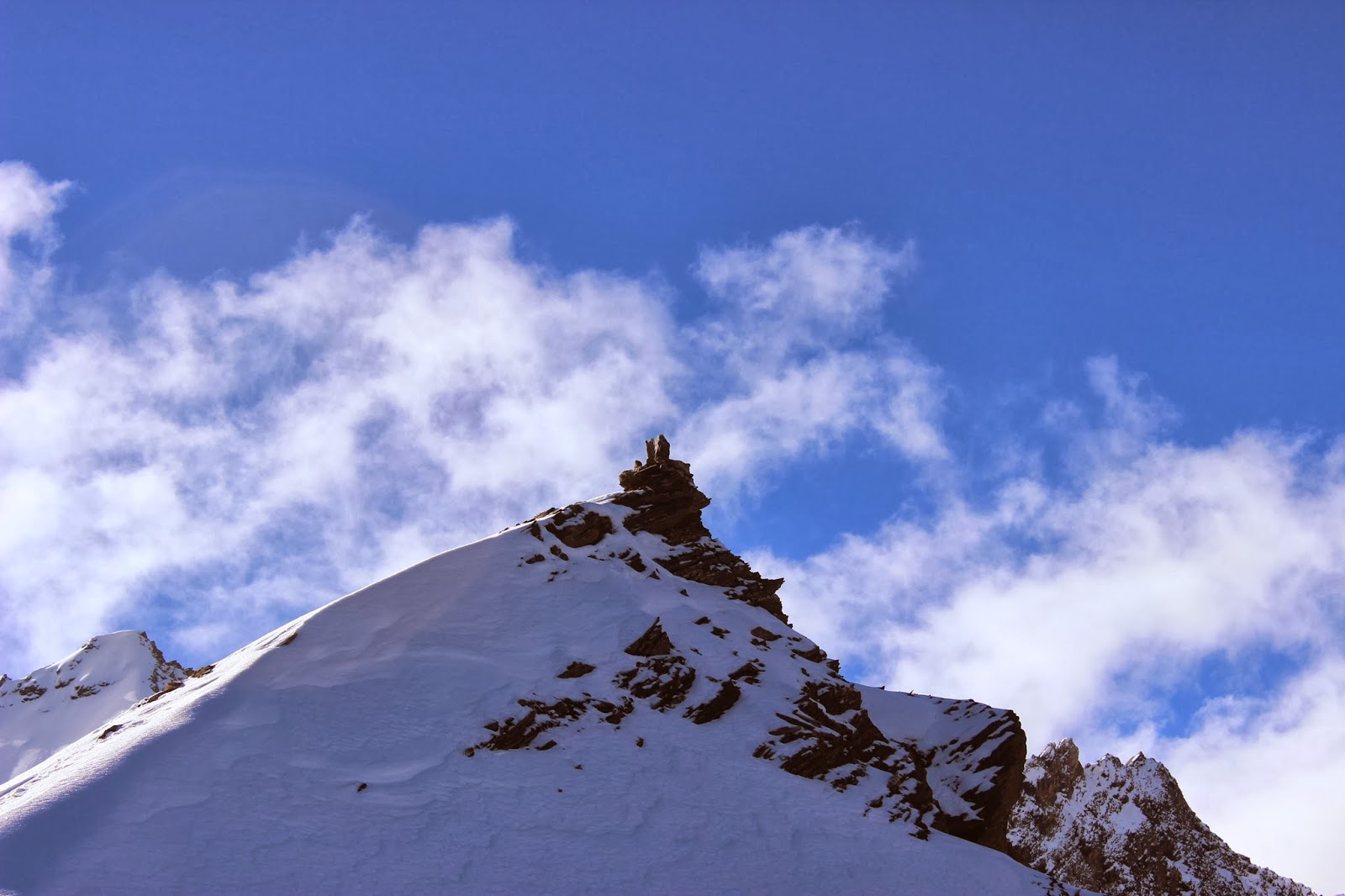
Having hiked so far and to be on the summit!

It was trishul and Nanda Gunti! Which sto
od  much taller than the current one. Could be 2000meters more than this one.

After the enjoying the view around the summit. We descended back to Roopkund Lake, and it was total difficult, steep downhill walk in the snow, as rays of sun melt the snow into slippery layers. I was very conscious, but still I stumbled twice! Lucky escape from the free fall!! That would have directly buried me along with thousands who have died here few centuries ago.

The Bhagwabasa Campsite (in the balcony of Himalayas)
After having a break near the kund, we started to walk back towards Bagwabasa Camp site.  It’s the time to give some work to my camera. We reached bagwabasa and had lunch there. As it was after noon, weather changed dramatically. All the clouds gathered from nowhere, before we could start realizing, it was hailstorm! It pushed everyone inside the tent. Since all other tent were taken off, as ours was the last batch of hikers for the season. One big tent to occupy all, there was no clear space to
sit and relax a bit. Since the day was started for us 3am in the morning and everyone was tired. There was no other option but to reach the Patal Nachauni campsite as soon as possible. Since this particular camp is almost removed and if we dared to stay here, we would freeze to death for sure without sleeping bags and proper tents! So, we time boxed our waiting period for the hailstorm to get over. But it still continued past 2:30pm. So wore our raincoat and set out in the open to reach the next campsite. On the way we stopped nearby Kalu vinalak mandir again to have water and dry food.  Then again it was total downhill with clouds all over us. Visibility was much less; even the person in the 20 meters distance could not be reached. We descended down in the brisk pace. But this tiredness, lack of sleep,  let us down! We walked almost 2 hours again downhill. That time never seemed to end like the other day. Finally we reached patal nachauni campsite and walked directly into the tents and then into the sleeping bag. Such a tiring day it was. Since the camp has been setup in the open end of the mountain. It wind was very chilly, Could not with stand chilly wind after that tiring day.

We walked almost for 14hours that day! There by beating my personal record of 12hours back in Western Ghats. :P


Day 5: Patal Nachauni -> Gairoli Patal (via Bedni Bhugyal)


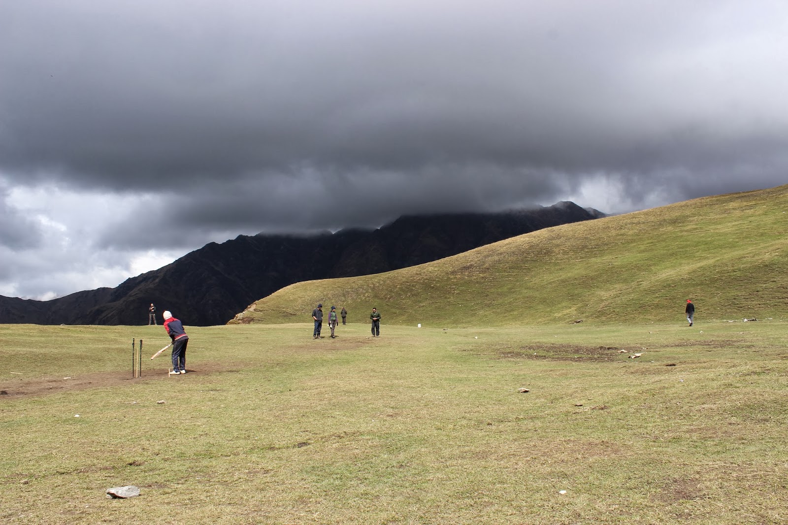
Playing Cricket @ 12,500feet 
We left Patal Nachauni campsite at around 8:30 am. And it was plain walk on the narrow path that bridges two mountains.  After 2-3 hours we walked down to Bedni Bhugyal. (The same place where we camped in the uphill journey). Had break there, played cricket for an hour again! And then we took a different route towards Gairoli Patal.  The downhill walk inside the forest was very good!

Gairoli Patal Campsite.


We reached Gairoli Patal campsite. The most beautiful campsite of the trek! (Inside the forest), It has everything one can ask for. We wandered around the campsite in exploring various things, the kind of trees, slope, streams and stocks are mind blowing. We played volleyball, and it was total fun. Then we were asked to collect the fallen wooden pieces to setup a campfire.  Then it was the campfire and every team had to perform something for the campfire. We had very good time performing around the campfire.


Day 6: Gairoli Patal -> Lohajung base camp (via Van village)


The flowing water stream on the way to Van.
We started little late in the morning. It was normal downhill walk. The path was clear. We took some shortcuts to get some time to stand and enjoy the beauty of the nature around. We descended down to a valley, where a stream flows, which is similar to what I had seen in the first day of the trek. It was beautiful. And it suddenly started to rain from nowhere. That is the case with valleys in the Himalayas after all. Sudden rain, sudden sunshine was part of our entire journey. Along the way we encountered a village that resembled fictional shire ‘Hobbiton’. So green, so beautiful!  We reached a village that had road connectivity to the external world (Van village!!)  Then we boarded the vehicle which was waiting for us, to reach the Lohajung Base camp.

We reached Lohajung, our base camp and had lunch!! Then called my home to tell about the entire adventure. Meanwhile everyone took shower after so many days! It was a refreshing moment. It was a time for us to try different food, other than what we ate in the camp. Nothing can be better than tasting some Maggi noodles after so many days (with some chilies of course, that’s what we missed in the camp).


Time to say Bye:-


Our Hiking Batch @ Roopkund summit.
Next day we got up late in the morning, as we always were. Got freshen up and had breakfast, we packed everything that we left in the camp during our trek. Vehicle was ready to leav
e us to Katgodham to catch our bus or train to Delhi. On the way, all those mountains looking as if they are calling us again, we stopped multiple times to look around. Finally at 5:30pm we reached Katgodham railway station, our reservation request was still in waiting list. We were not sure if we should take train or bus. Then we decided to go by bus from the Haldwani Station. After having dinner in a local hotel, we boarded the bus. The bus was in good condition; unlike the bus we have taken the other day from Delhi to Katgodham.


I had done different kinds of treks back in Western Ghats, but I would say this was the first of its kind, very unique experience in terms altitude, weather and accessibility. Totally into the wild!!

Everything seems to change after first Himalayan Trek. You will not be the same person as before. Many things you learn in this kind of activity that, it will become of part of your daily life.
Our Guide used to say, “Mountains are mirrors who we are!”; and we realized, it is very much true.
Now I wouldn’t regret having done this particular expedition, and it is the most memorable adventure I had till date.


Sunday 13 January 2013

The Next Big Thing : Big Data


        Data is an important asset of an organization. Every organization is generating data in one or the other way. For any damn business decision they use the data to back it. When the amount of data increases, managing and processing of such a huge amount of data with traditional technologies becomes challenging.
  Big data is the any amount of data that we can think of and the problems that associated with managing that data.

 When an organization has few Giga Bytes and Tera Bytes of data, there will not be any major problems in managing that amount of data in currently existing the technologies like Databases or standard storage devices.
When the data size grows exponentially it becomes the very difficult  to provide the reliable, easily scalable and cost effective solution using the traditional data technologies.

  To provide the reliable, scalable and cost effective solution one has to think in terms of using the commodity hardwares for the storage. when I say commodity hardware it means cheap,low end, non server class machines for storing the data.
But how can we rely on cheap machines to store the important data? If one machine goes down, data hosted by that particular will not be available. No?
Yes,  cheap, low end, non server class machines are less reliable than the higher server class machines.
 But, one should build a system such that, even if one of the machine hosting the data goes down, data should be available from the other machine.
      You may be wondering how the data will be available if machine hosting the data goes down.
If so, you are thinking right. Yes, I'm talking about the replication. Replicate the data so that data will be available in other machines as well.
     System should be such that one should be able to add the machine for storage and total storage space of the system should increase. This is called the horizontally scalable system.
    Coming to the cost, yes we are talking about the commodity hardwares so even if hardware goes bad, just throw away that machine and use the add the new one.
 As the web based services are increasing, more and more popular organizations are  trying to capture the user activities and deduce the behavior over time, so that they can target some services or ads.
      
    Now everyone is realizing the power of data. No doubt it will be the next biggest thing in the industry along with cloud.


Sunday 18 November 2012

Trekker's Heaven - Kumara Parvatha


     This was the trek, that we were postponing from long time. We are totally 7 memeber team Me, Revant, Ravindra, Jnanesh, Shivu, shivu and Chinthan.

We started from bangalore on friday night in a private bus to Kukke subrahmanya. We reached there by 4:30am in the morning. Unfortunately it wasn't going near the temple.
So we had to walk 2 miles or so to the river, where we had bath and finished all the activities. Even though the it was January, the water was not cold. We easily had bath and
and there was no much water also.
A view of Kumara Parvatha.

From there we took autorikshaw and entered the temple. After all the darshana, Revant had one sarpa samkaara to do. As he told his mother as he's going for only visit the temple.
she didn't know about the trekking part of our trip. :P
then we came out of the temple and had break fast in a hotel near the temple.
packed all the things we needed.

we already had 100 chapathis, 2 bottles of pickle, and 2 packets of chutneypowder and apples. We bought the bananas and water bottles of 2 litres, The bad part was each one
of us had to carry 2 bottles of water along with what we had in the bag plus the tent or sleeping bag. I had camera also, which was adding to total weight of the bag.

Then we asked the nearby shop keeper for the road to the Kumara parvatha. he showed one.


Kumara Parvatha peak is in the Pushpagiri wildlife sanctuary, Western ghats. It's the border between Dakshina Kannada and Coorg Districts.  We need to take permission to trek here from the forest office on the way.


We started from there and it was almost 2kms to reach the base of the kumara parvatha. It was the tar road where vehicles were moving. We called our parents as where we are
and also told them we will not be reachable on phone for 24+ hours, as we thought there will not be any network in the peak.

Phase 1:

Kumara Parvatha mountain range distant view
There it started, a Diversion from the main road directly into the what it looks like forest with big trees and steady steep the narrow path.
We knew it will be there for next 5kms. The trees were protecting us from the sun. but the steady steep was tiring both for legs and heart, as we were carrying more luggage.
We took the break near the fallen tree and drank enough water. we saw the path forward, it was showing up as if that steep path going endlessly.
On the way we saw some people who are coming down, who had gone there the previous day. We asked them how far is our planned lunch destination (Bhatra mane in Kannada) Bhtta's house

they said it is around 1hr hike from there. We were happy, but actually it took them 1hr of down hill to reach there.
We started again, then  walked for another 1/2 hr. (though I had lots of  small breaks in between) there was a banayan tree with and actually that was the first stop
for all others.:P, but it wasn't our first) there we had energizer apples and water. we clicked some photos giving different poses with banyan tree.

then We resumed, walked all over, inbetween I used to take lots of breaks :P, then after 1hr of walk we reached place which was open. direct to the sunlight. there were no trees
Bhatta's Gaden
only the open grass land. initially it looked nice as there was no steep, after some time we felt more tiring as sun was eating up all our energy.

We saw backwards, And we couldn't believe what we saw. the subramanya with all the building were visible like match boxes kept in a sequential order.

We reached Bhatra mane, where we had lunch.. As we were very hungrym, we ate like never before. Took some power nap @ bhatta's garden.

Then we started again,

Phase 2: Most difficult part of the trek in the afternoon.

That is open steep grassland, with sun right above our head. We started that stretch with refreshed feeling. With ease we reached 1st stop after the lunch,
that had view point with the seating arrengements. We sat there for sometime. but this sun made us get going.
From that point onwards it was like hell. Hiking in scorching sun is very difficult. Then we stopped for every 50 steps we walked. There was absolute void except for the scorching sun
and the dried up grass. The food we had for lunch was digested before 1/2 an hour.So we were trekking using the reserve energy of the body.It was so tiring.

After some time, we had to take out the apples and eat it. Actually apples are good instant energy agents. We felt little better. Then we started again.
We started to spot one high peak, we were happy that we were able to spot the peak. After almost 2 and 1/2 hrs of the hiking,
we reached a place called mantapa. Normally people camp there for night. We took some rest.Initially we were under the impression that the mantapa is the actual last point.
But when we reached mantapa we spotted another peak in front of us. We were very tired.


Phase 3:

then we started towards that peak, It was 4 1/2pm and we were moving in the opposite direction of the sun. so, this time we didn't face much issues. After one hour or so people in our
group started to feel hungry, we all gathered on the connecting path between the 2 peaks. we started to eat chapathis that we brought so that we can reduce the weight of our
bag, meanwhile we were running out of water.

Our group splitted into two, 1 group was in hurry to reach the peak before the sunset. So I chose to be in the second one, since I was already tired.
Then started to climb the peak ahead of us captured some amazing scenaries on my camera.It was simply awesome, As we continued we got to see very good view of the landscape.

We were definitely lucky enough to watch the sunset. After that everything cold breeze everywhere, temperature suddenly started to drop.
After the sunset we climbed the peak and were very happy that we conqured the quest, but we didn't see our other group there. then some group from the behind told us that, this is
not the Kumara Parvatha, instead it is Shesha Parvatha and showed us another peak infront of us which was little far and to go there we have to go down in the jungle and climb it.

The sunset captured at Shesha Parvatha
We had no clue what was going on. Since all the tent ,food and water were with other group.And this is certainly a most adventurous part of the trek. We entered into the jungle like
narnia land without a torch and there is no clue about where we were heading in the little dark trail.

After about 30mins of walk we spotted our group searching for the water near some little water source in the same narnia land.

then we started again. and it was already 7pm.
This was the most steepest and dengerous part of the trek, where we had to climb what it looks like the seasonal water falls which was very steep. If you miss 1 step there, that's it.

It took another 45mins to reach the peak.
And that was the true feeling of satisfaction. A true quest we conquered in a day.

We opened our tent and called home. We put some camp fire, to keep us warm from cold breeze.
had chapathis again and had enough water. Sat and discussed about the uphill trek and fell asleep.
Because of the chilly weather I couldn't fall asleep so easily. The air was blowing as if some storm will come and take our tent along with it.

Sunrise @ Kumara Parvatha
Next day morning we woke up early and marched towards the end point(view point) to see the sunrise. Waited for almost 30mins for sun to come online for us! And were spell bound to
after watching the sunrise. We were able to see the shadow of the Kumara Parvatha falling on the near by villages.
Watching the sunrise is one of the purest and refresing moments, after all effort we had put to reach that point.

had break fast and packed the rest of the food and water started downhill trekking. Down hill trek was comparitively easy considering that we had started early, as we had a good learning
from the previous day's trek.By 10:30am we reached Bhatra mane, ate whatever they cooked, started again. Reached the base by 2:30pm


Kumara Parvatha trek is one of the difficult treks. It took us almost 11hr for uphill trek, nevertheless we had a great experience of camping near the summit and witnessing both sunrise and sunsets.
I could proudly mark this event in my Resume :D